Experts say Nepal’s deadly August 26 floods were triggered by a massive ice and rock fall in the Himalayas, not an earthquake or glacial lake outburst. The disaster devastated the Bhotekoshi corridor, killing over 900 people and leaving thousands missing
Published Date – 31 August 2026, 07:30 PM
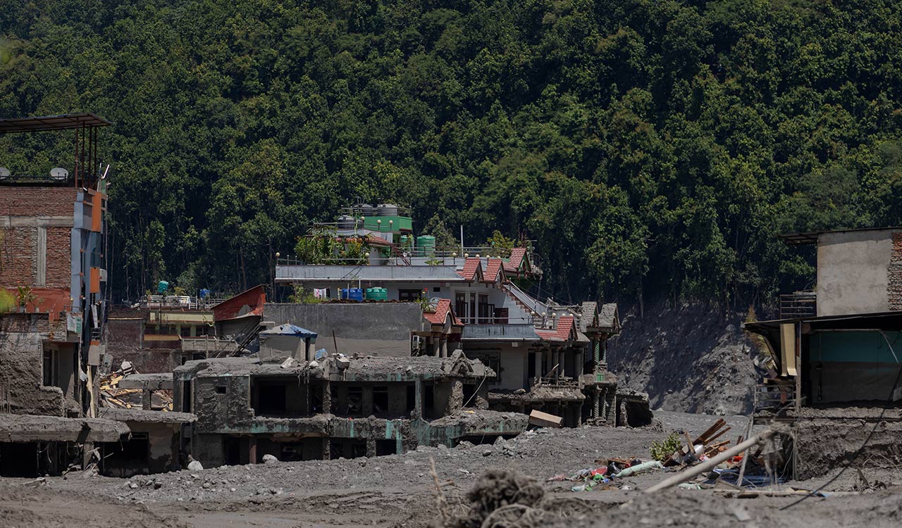
Kathmandu: The devastating floods that swept through Nepal were triggered by a massive fall of ice and rock in the high Himalayas and not by an earthquake or glacial lake outburst flood (GLOF), according to experts. The flash floods that triggered near the Nepal-Tibet border on August 26 swept through the Bhotekoshi River corridor, destroying homes, roads and bridges and damaging hydropower projects.
The death toll from the disaster crossed 900 on Monday, while over 4000 people remained missing, according to the National Disaster Risk Reduction and Management Authority.
A study, commissioned by the Nepal Environment Society (NES), found that a huge mass of ice, rock and debris fell from around 5,200 metres in the Langtang Lirung area of Rasuwa and entered the Lhende River, generating a powerful debris-laden flood that travelled downstream through the Bhotekoshi and Trishuli rivers.
Bishal Nath Upreti, president of the Nepal Centre for Disaster Management, said initial theories that the disaster was caused by a GLOF or an earthquake had subsequently been discarded.
“Initially, many thought it was a glacial lake outburst flood, or GLOF. Later, it became clear that there had been no lake burst in Tibet along that line, so that theory was discarded,” Upreti told PTI Videos. It was then thought that an earthquake had triggered the ice and rock fall, but the US Geological Survey later clarified that the sequence was the other way around, he said.
“A massive rock and ice fall into the valley generated the earthquake,” Upreti said, adding that the earthquake was initially recorded at magnitude 4.2 and later revised to 5.2. “So, the disaster was not caused by an earthquake; rather, the falling ice and rock generated the earthquake,” he said.
The NES study, released on Sunday, also concluded that the disaster was not caused by a GLOF. Researchers from NES analysed satellite imagery, hydrological and meteorological data, terrain characteristics and changes in elevation and slope along the river system and found no evidence of a lake outburst.
According to the study, the ice-rock mass began falling from the northern part of Langtang Lirung at around 8:37 am on Wednesday. It descended steep terrain from about 5,200 metres before reaching the Lhende River at around 2,930 metres.
Satellite images showed major geographical changes across about 10 square kilometres, while a section of glacier covering approximately 0.56 square kilometres had broken away. Upreti said scientists were still trying to establish the precise mechanism behind the disaster as no one had yet reached the site and much of the research was based on satellite imagery.
“One emerging hypothesis is that it was actually a massive rockslide, with the ice riding over the falling rock, rather than the glacier itself sliding down,” he said, cautioning that the theory could not yet be confirmed.
The NES study found that the ice-rock mass travelled about 22 km to Rasuwagadhi in just over seven minutes, reaching an estimated average speed of 46.3 metres per second, or 167 kmph. Its speed fell to around 73 kmph between Rasuwagadhi and Betrabati and to about 22 kmph further downstream. Despite slowing, the flow continued carrying huge quantities of rock, sediment and soil, the report said.
The study also found no evidence of exceptionally heavy rainfall in the upper watershed that day, weakening the assumption that the disaster was caused solely by extreme rainfall or a cloudburst. Upreti said a second, smaller flood occurred after another landslide around three hours and eight minutes later created a temporary dam that subsequently breached.
“Fortunately, it flowed slowly and did not result in a major disaster,” he said. The floods also caused extensive damage to hydropower infrastructure. Citing preliminary Nepal Electricity Authority data, the NES report said 13 hydropower projects and one solar project were affected, taking around 431 MW of generation capacity out of the system. The study said further field investigation was needed to determine the precise geological mechanism, the contribution of melting ice and whether the river was temporarily blocked upstream.